Overview
Flood Inference Plugin is a QGIS tool that leverages deep learning to provide real-time flood predictions. Designed for urban planning and disaster response, it simplifies flood risk assessment by automating complex workflows.
Features
AI Flood Prediction
Runs a PyTorch-based model on DEM & rainfall data for rapid flood analysis.
User-Friendly Interface
Simple GUI allows users to configure parameters and visualize results effortlessly.
Automated Visualization
Applies intelligent color mapping to generated flood depth maps in QGIS.
How It Works
Load a DEM and select a rainfall scenario.
Preprocess data, normalize values, and extract terrain features.
Run the AI model and generate a flood depth map.
Automatically display results as a GeoTIFF layer in QGIS.
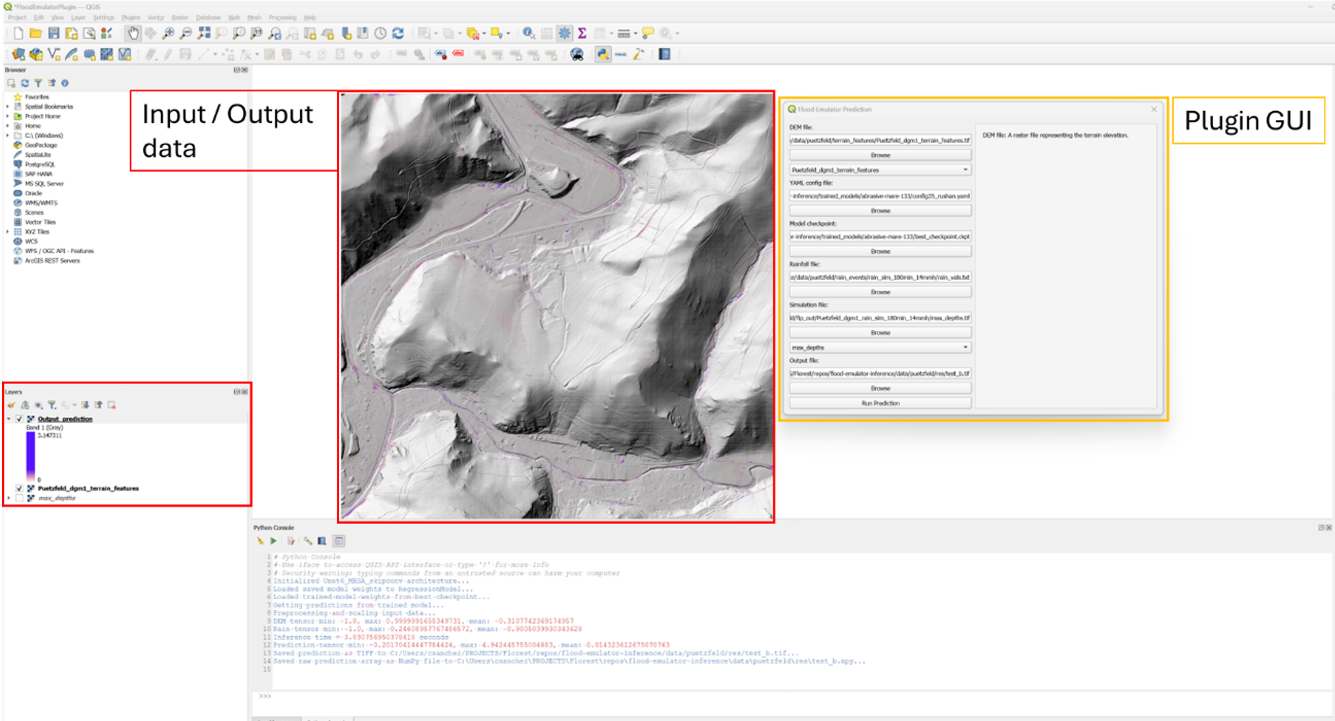
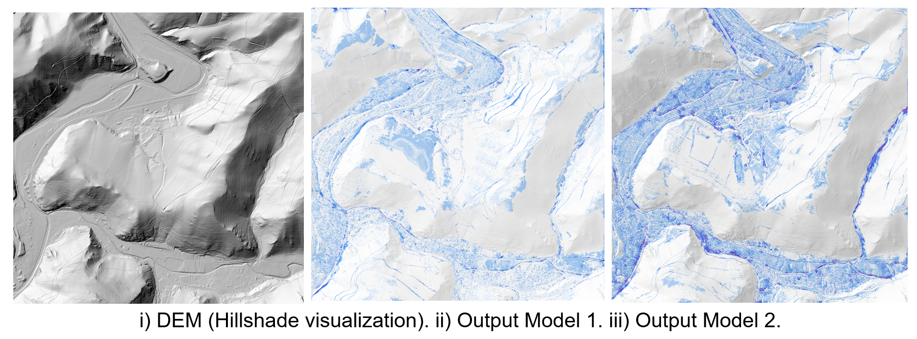
Plugin Screenshots
Want to Know More?
Contact me for more details about the Flood Inference Plugin.
Email Me