Overview
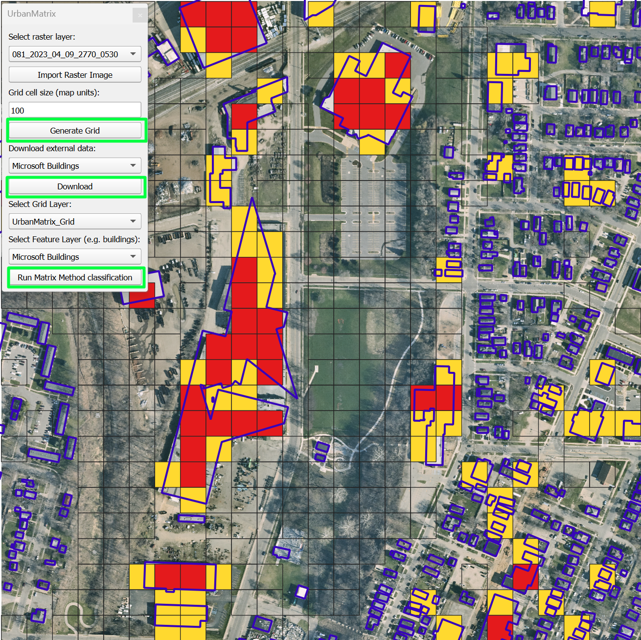
UrbanMatrix is a plugin for QGIS that brings automation and structure to the Matrix Method, a technique used for environmental and urban classification. It enables users to assess building density and other spatial indicators through a user-friendly interface, integrating real geospatial data and applying a customizable classification pipeline.
Features
📐 Grid Generation
Create analysis grids from any raster or map extent.
🏙️ Building Footprint Integration
Download and analyze Microsoft building footprints.
🎨 Auto Styling
Applies intuitive styling to grid and building layers.
🧮 Matrix Method Logic
Classify risk levels (Low, Moderate, High, NoData) based on spatial coverage.
🔄 GUI-Driven Workflow
Run the full analysis via an intuitive QGIS interface.
🧠 Python + QGIS
Built using PyQt, PyQGIS, and GeoPandas.
How It Works
- The user selects a raster or map area and generates a custom grid.
- Buildings can be downloaded or imported to run automated spatial analysis.
- Each grid cell is classified based on coverage percentage.
- The plugin assigns a risk score using Matrix Method logic.
- Results are automatically visualized and ready to export.
Resources
Screenshots
Want to Know More?
Feel free to reach out or explore the plugin in the QGIS repository.
Email Me